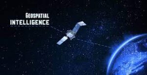
What is Geospatial Intelligence?
Geospatial intelligence is intelligence that is derived from geographic locations and their features. It is a type of intelligence that has been in use for many years, but it has become the best way to analyze data. GIS can be used to map data points and find patterns, or it can be used to predict future events. Geospatial intelligence is the use of data and spatial relationships in conjunction with methods and theories from geography, statistics, geology, cartography, photography, and computer science.
Geospatial intelligence can be used to acquire information about spatial patterns as well as predict future events. It is a type of intelligence that has been in use for many years but it has become more sophisticated and more widely used since the end of the Cold War. In a global economy, geospatial intelligence is not only important for national security but also for understanding how people relate to their environments. Spatial patterns are locations in which items or events occur.
History Of Geospatial Technologies
Geospatial intelligence is a term used to describe the study of geographical information and its application in national security and emergency management. Geospatial intelligence has been used for centuries to map out locations, but it wasn’t until the mid-20th century that this information had practical applications.
In today’s world, geospatial intelligence is essential to our lives. It provides us with valuable insight into natural disasters, terrorism, and crime prevention. This technology is also crucial in the field of disaster relief because it helps responders identify affected areas and plan relief efforts more efficiently.
What Is Geospatial Intelligence?
Geospatial intelligence refers to the use of imagery and geospatial information for surveillance, reconnaissance, understanding, and crisis management. This is a more formal definition coming from GEOINT’s creator himself – retired Air Force Lieutenant General James R. Clapper.GEOINT, as the name suggests, is a domain of geospatial information that includes imagery and anything derived from processing. It also includes things like geospatial data.
These types of data can be collected on stationary and moving targets by electro-optical, SAR, related sensor programs, and non-technical means (including geospatial information acquired by personnel in the field).
Government agencies have been investing in GEOINT systems and they are not the only ones. Business intelligence firms also use GEOINT to transform their business in different ways and fields. For example, it can be used by companies that focus on mobile needs, or for companies that sell products at a physical store location.
What Does Geospatial-Intelligence Do?
Precision Location Data
GEOINT is a type of artificial intelligence that will allow your application to use location data from billions of mobile phone users and offer better services. Precision location data also applies to vehicles, ATM transaction locations, and online activities.
Remotely Sensed Information
Businesses will soon be able to use GEOINT / GIS analysis of high-resolution satellite imagery. Reusable, commercial rockets as well as smaller, less expensive satellites will help make this type of analysis more accessible. It’s not just agriculturalists and disaster response personnel who will be interested in drones. They can provide still/moving image capture of anything from a family farm to an earthquake-hit region.
Processing Power
However, this potential is only a possibility when large-scale computing power becomes even more readily available. GEOINT data will grow in usage for many purposes, including humanitarian relief. For example, crisis mapping can be crowdsourced to complete rescue efforts faster and more effectively.
Data Analytics
Data and predictive analytics will be improved by advances in health care, telecommunications, utilities, banking & insurance.
Virtual Reality, Augmented Reality and geospatial data are important to accurately map locations in gaming, VR, and AR environments. VRC Location Providers is a mapping tool that helps developers create virtual reality-ready games, AR, and geospatial applications. Developers can use the tool to claim and manage locations for their projects. The software is designed for easy navigation in 3D space allowing users to navigate, measure distances, and scale objects.
WHAT IS GEOINT?
GEOINT stands for GEOspatial INTelligence. It’s a discipline that falls under the umbrella of imagery & geospatial information. It includes the exploitation and analysis of imagery to describe, assess, and visually depict physical features and geographically referenced activity.
GEOINT is not just for militaries!
It involves disciplines like mapping, mapping, and intelligence. Increasingly it’s being used by private organizations in the commercial sector who are working in foreign territories. Industries such as telecommunications, transportation, public health – safety, and real estate are using geospatial intelligence to improve the quality of everyday life.
The basic principle of geo-location is to use all available information next to its geographical position on Earth. And make decisions or products that use emergency responders and decision-makers.
How to Use GIS as a Tool for Your Small Business
GIS is a powerful tool for small business owners. It can help you to make better decisions and increase your profits.
It can also use to help you understand the impact of potential changes on your business, monitor the progress of your customers, and track the flow of goods in and out of your store. The most popular GIS software is ArcGIS. However, it requires some expertise in order to use it properly. That’s why we recommend that you use a free GIS tool like Esri’s ArcGIS Online or Google Maps API. Geographical Information System (GIS) software.
A Guide to the Integrating GIS into Your Marketing Strategy
Marketing is a process that requires a lot of planning, creativity, and resources. It takes time and dedication to make it work for your business. In order to get the most out of your marketing efforts, you need to be aware of the latest trends in the industry, know what customers want and need, and understand their behavior patterns.
GIS is an important tool for marketers because it helps them understand how people think about their environment. Geospatial intelligence can help marketers understand where they should target their marketing campaigns based on where they are able to reach their target audience. By looking at a large enough network, marketers can see which people are in certain areas and then find the best way to deliver their message. In other words, geospatial intelligence allows them to understand population density and the flow of people in different areas.
Some examples of how geospatial intelligence is used by marketers include predicting the location of a new store based on data collected from an area and determining whether or not they could sell out a certain item. Geospatial intelligence also uses in retail marketing, allowing retailers to understand the best locations for stores and which demographics shops should target. Geospatial intelligence is useful in other sectors as well, such as real estate.
Why We Are Using Geospatial Intelligence in Our Life
Geospatial intelligence is a field of intelligence that deals with the use of geospatial data to understand and anticipate events. In conclusion, we should be using geospatial intelligence in our lives because it has the potential to help us make better decisions in our personal and professional lives.
we should be using geospatial intelligence in our lives because it has the potential to help us make better decisions in our personal and professional lives.B. Geospatial intelligence is a field of intelligence that deals with the use of geospatial data to understand and anticipate events. In conclusion, we should be using geosp